

TerriaJS is a feature rich open source solution for building amazing spatial data federation web platforms.
TerriaJS powers world-leading platforms such as Australia's NationalMap and the New South Wales Digital Twin Visualisation Service and facilitates the exploration of satellite imagery from Digital Earth Australia. Data publishers can assemble catalogues of spatial datasets with a combination of hand curation and federation - live querying of online data services.

Expression of Interest
Calling all urban planning, infrastructure, environment, and data professionals - Accelerate your digital twin readiness with Terria!
Join our exclusive Digital Twin Early Adopter Program (EAP) now! As an EAP participant, you’ll gain exclusive access to Terria’s Spatial Digital Twin proof of concept. Plus, you’ll get a special discount for the program's first three months and have a seat on our Customer Advisory Group to influence the product strategy. Hurry, places are limited - Fill out our webform to register your interest today! Visit our EOI page to learn more!
Features

3D and 4D visualisation
Visualise your data on 3D terrain, fall back to 2D on older systems or switch between them on the fly, based on Cesium and Leaflet.

Comparison tools
Compare your datasets using the image splitter and date picker. Works best to compare data at different points in time, or different datasets.
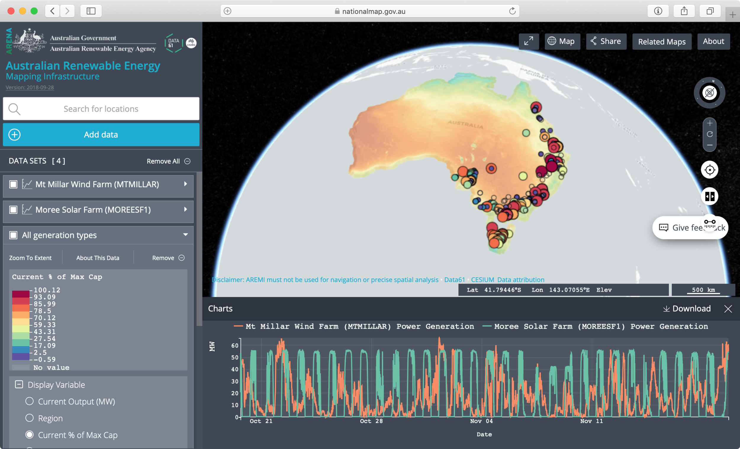
Charting
Easily analyse the underlying data from map features or external sources, using rich and interactive charts, and export the results.

TIME-SERIES SUPPORT
Explore time-varying WMS layers, watch vehicles move smoothly across the map and observe your CSV data change over time.

LIVE DATA CATALOGUES
Present a dynamic catalogue for existing WMS, ArcGIS, CKAN, CSW, Socrata, WMTS of WFS server, curate the catalogue by hand, or use any combination thereof.

GEOSPATIAL FORMATS
Visualise WMS, WMTS, WFS, KML, GeoJSON, CSV, CZML, GPX, and many more spatial formats out of the box, or easily add your own.

GEOPROCESSING
Allow your users to specify Web Processing Service (WPS) parameters from the UI and visualise the result in your workbench.
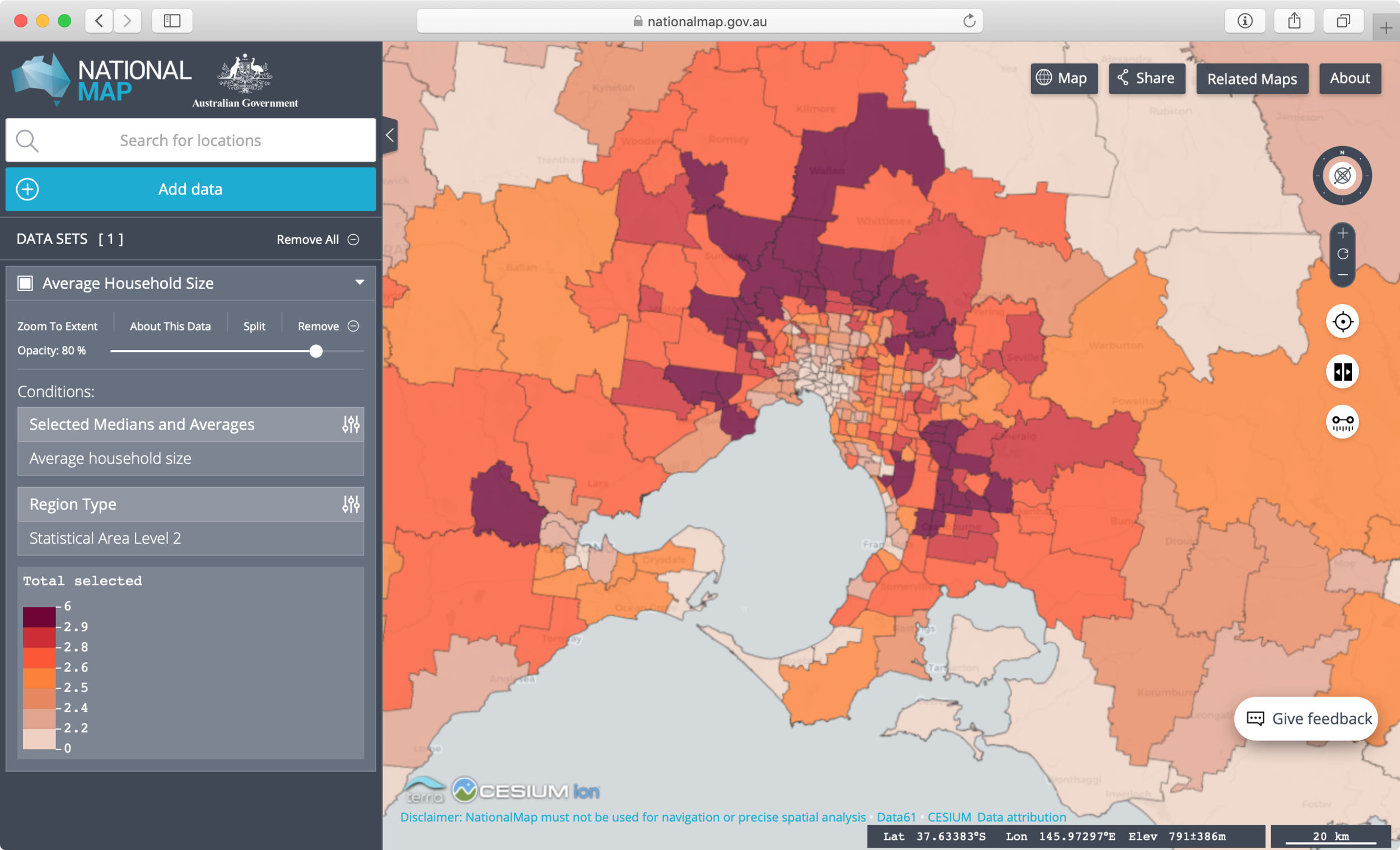
AUTOMATIC REGION MAPPING
Simply drag-and-drop a CSV file of region names and values for TerriaJS to automatically visualise it on the map.

INTUITIVE, RESPONSIVE UI
Includes a React-based user interface designed and tested by UX professionals to excel on phone, tablet or desktop.
DATA STORIES
Compose and share interactive data stories directly from the map.
change detection (delta)
This feature will allow users to examine satellite imagery for an area over a period of time and determine what changes (if any) are indicated.
SCene editor
Support for users adding and manipulating own 3D data in glTF format. This feature is available freely for all users but it hasn’t yet been open sourced. To register your interest, please contact info@terria.io.
Partners & Projects

Since 2014, TerriaJS development has been supported by NICTA and CSIRO Data61 in collaboration with Australian Government agencies at all levels, such as Department of Communications, Digital Transformation Agency, Department of Environment, Australian Renewable Energy Agency, Geoscience Australia, Bureau of Meteorology and many others. As a result, TerriaJS powers world leading platforms, such as NationalMap, NSW Digital Twin Visualisation Service, NEII (National Environmental Information Infrastructure), Digital Earth Australia and many others.
Get started
TerriaJS is a rich library for geospatial visualisation thanks to support from its founding partners and community. You can make it better!
The easiest way to start is by cloning our boilerplate project:
TerriaMap: https://github.com/TerriaJS/TerriaMap
Full instructions: https://docs-v8.terria.io/guide/getting-started/
Follow our development and contribute on TerriaJS GitHub
Chat on Terria GitHub Discussion Forum
-

-
We're proud to be among the first #CesiumCertified Developers! Learn more about @CesiumJS program and join us in gr… https://t.co/Sa5cIZiUTB
-
RT @CesiumJS: Get Cesium Certified! Our new Cesium Certified Developer Program recognizes those developers with expertise in th… https://t.co/NqhCkxpPCz
-
Yes, Digital Twin Victoria is live! Big thank you to @CesiumJS for supporting @TerriaJS and the digital twin open e… https://t.co/P8afpLRTw5