Case study

Digital Twins empower governments to build user-friendly, transparent platforms that seamlessly aggregate and provide the public with access to critical and diverse datasets.

Government

Discover how digital twins are making government spatial data more accessible

Mapping and digital twin platforms are transforming the way governments, industries, and communities utilise geospatial data. Spatial data facilitates better decision-making, promotes collaboration, and improves public engagement.

Since its inception in 2014 as a government initiative, Terria has leveraged its open-source platform to develop user-friendly, data-rich solutions. By collaborating closely with government and research stakeholders, Terria has tackled complex challenges while fostering openness and innovation.

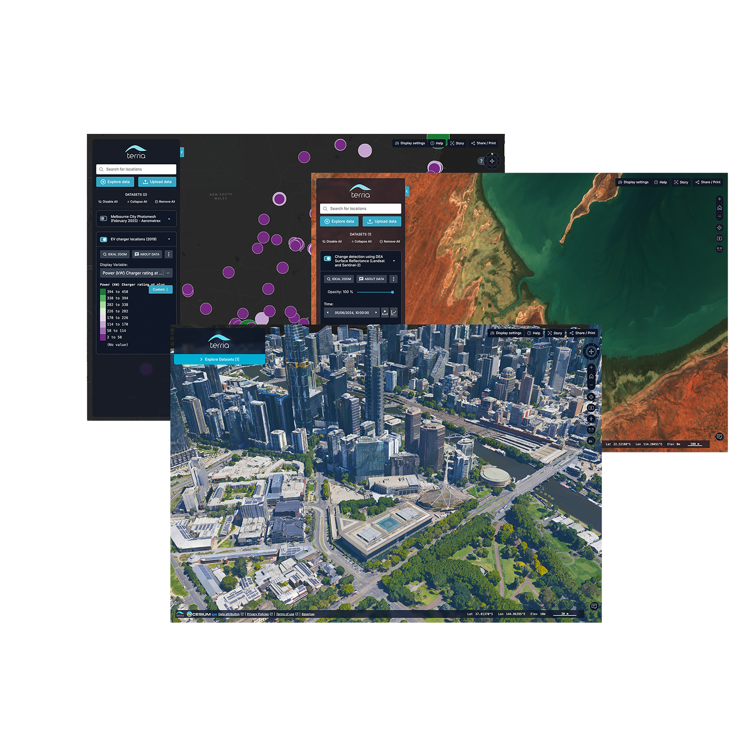
Platforms like Digital Earth Australia, the NSW Spatial Digital Twin, and Digital Twin Victoria (DTV) that utilise TerriaJS demonstrate how advanced spatial technologies, combined with robust datasets and strategic partnerships, can drive transparency and efficiency.

The Challenge 

The Barriers to Accessing Government Data 

Accessing government datasets has historically been a fragmented process, requiring users to navigate multiple platforms and formats. This creates significant barriers for: 

  • Businesses: struggling to streamline data for project planning, market analysis and risk management 

  • Researchers: facing delays in acquiring data for scientific studies or publishing their findings openly

  • Educators: seeking data-rich resources for teaching and learning

  • Communities: wishing to engage in local planning or environmental advocacy. 

The need for intuitive platforms that facilitate access to Government datasets at all levels, from the Commonwealth to Local Councils was clear. The challenge lies in consolidating this data into ‘one-stop-shop’ platforms while maintaining transparency, usability and scalability.

Our Response 

In collaboration with its stakeholders, Terria provided the foundation for platforms that deliver access to government datasets through: 

  • Transparency and accessibility: Open Source core technology that can be used by any government agency to build and expand their platforms for data publication 

  • Data aggregation: seamless integration of over 60 data formats and services, both proprietary and open, including direct federation from open data portals 

  • User-centric design: intuitive interfaces designed for both technical and non-technical users.

Examples of Impact

Digital Earth Australia 

Digital Earth Australia (DEA) is a program of Geoscience Australia, the Commonwealth Government’s Earth science agency. DEA creates free and open Earth observation data products for the benefit of all Australians.

Terria enables Digital Earth Australia’s mapping product to aggregate and publish Earth observation datasets into one platform for easy access and application by users into their projects.

Visit Digital Earth Australia Website

NSW Spatial Digital Twin

NSW Spatial Digital Twin is a program of work led by DCS Spatial Services which delivers a cross-sector, collaborative environment that enables the visualisation and sharing of location information, in a 4D model (3D plus time) of the real world, in near real time and to support improved decision making.

The NSW Spatial Digital Twin Visualisation Service (DTVS) is one of the visualisation products included in the program, alongside the Collaboration Portal, which hosts and catalogues spatial datasets across NSW Government. 

The NSW Customer Service Department in collaboration with CSIRO’s Data61 was the first government agency that in 2018 pioneered the development of Spatial Digital Twins in Australia, attracting international recognition. 

Terria’s open source technology and data federation approach supported the NSW Government in its exploration of spatial digital twins, while sharing the learnings with other Australian government jurisdictions and researchers across the country.

Visit NSW Spatial Digital Twin Website

Digital Twin Victoria 

According to the Victorian Government, the Digital Twin Victoria (DTV) platform is the most comprehensive digital model assembled for Victoria. It brings together masses of 2D, 3D and live data in a single online place open for everyone to use. 

As part of CSIRO’s Data61, Terria collaborated with the Victorian Government to develop the Digital Twin Victoria foundations by integrating existing 2D data, live data and new 3D datasets for the entire state. 

By iteratively working with government stakeholders, the project integrated advanced LiDAR data, 3D building models, and planning information, creating a digital twin tailored to the unique needs of Victoria's public sector.

TerriaJS has enabled the program to foster better community engagement. These contributions have solidified Digital Twin Victoria as a transformative platform, strengthening the state’s digital infrastructure and future readiness.

Visit Digital Twin Victoria Website

The Results

Platforms like the Australian NationalMap, Digital Earth Australia, NSW Digital Twin and Digital Twin Victoria exemplify Terria’s ability to address the challenge of accessing fragmented government datasets. 

These initiatives highlight the transformative power of collaboration, advanced technology, and open data policies. Terria’s expertise in spatial data and digital twin technology, coupled with its commitment to open source and human centred design, has enabled the creation of platforms with government datasets that drive positive change and build stronger, more connected communities.

Ready to start your journey?

Whether you’re a professional, data explorer or developer, our flexible plans and personalised services are designed to meet your specific needs.