
CASE STUDY
Building connected digital twins for infrastructure delivery
Digital infrastructure projects often suffer from poor interoperability between tools and lack of support for federated data-sharing, leading to disjointed systems, increased costs, and operational delays. For geospatial consultancy SiteDE, these challenges created barriers to client understanding and project delivery efficiency.
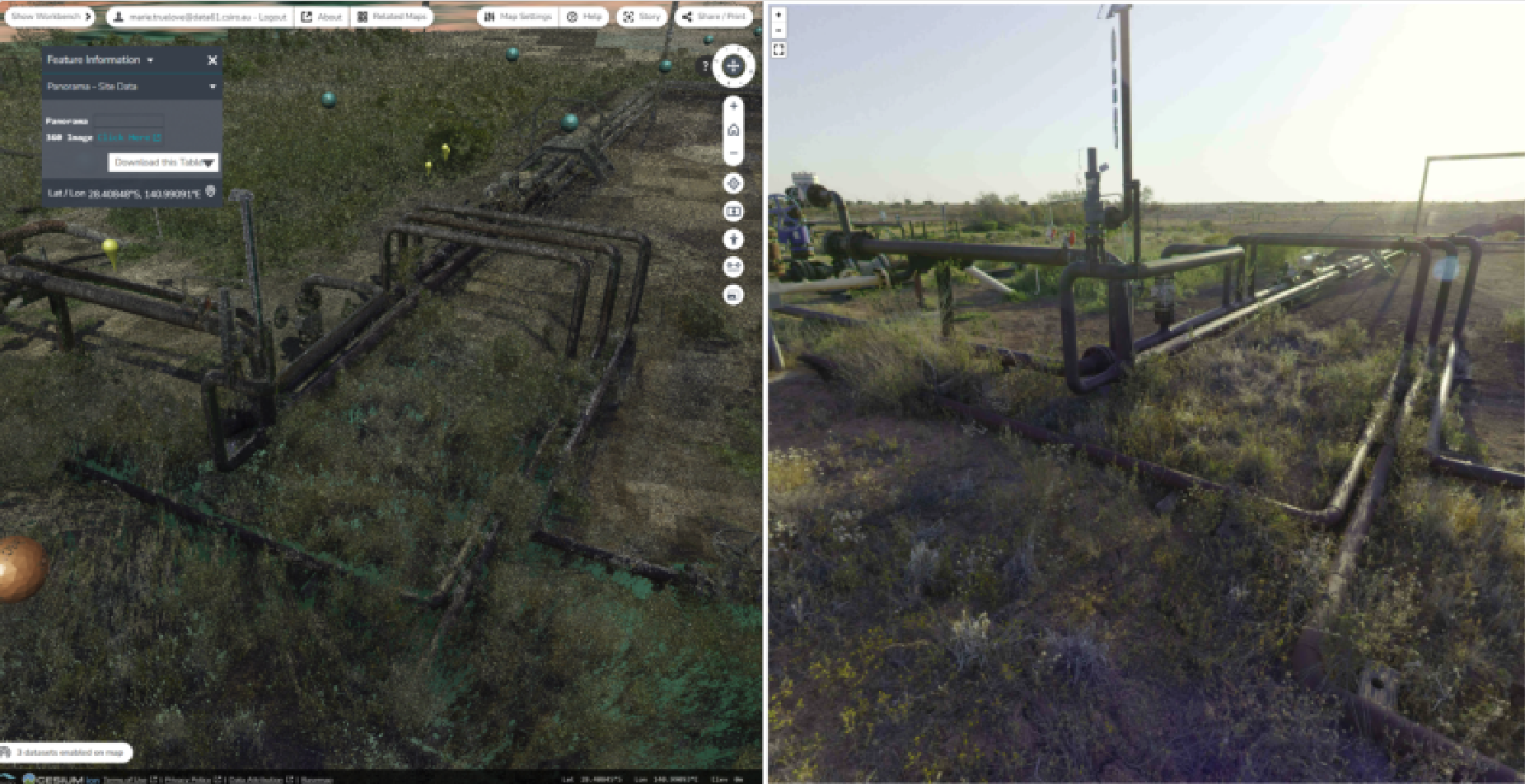
SiteDE Terria proof of concept. Infrastructure project with Lidar (left) alongside a connected non-Terria tool with panorama images (right).
Challenge: Lack of flexible, interoperable digital twin solutions
SiteDE required tools that allowed them to retain control of their project data assets, and ultimately the digital experience for their clients. For SiteDE consequences of tools that require copies of data rather than supporting federated approaches include delays, potential inaccuracies and the need for additional resources to manage and rectify emergent issues. Complex project data in unconnected systems can lead to client misunderstandings, and lost opportunities for future work. This can lead to increased costs associated with client acquisition and retention.
Solution: Building connected infrastructure digital twins
Terria launched the Digital Twin Early Adopter Program (EAP) to lower the barrier for organisations to adopt spatial digital twin technology. The EAP was designed to enable organisations to co-develop a proof of concept of a digital transformation use case critical to their own organisational needs. The EAP enables participants to trial Terria’s pre-market advanced spatial digital twin technology for their operations to improve efficiency, communication, collaboration and reduce risks.
Terria and SiteDE co-developed digital twin proof of concepts for multiple real-world infrastructure projects in energy and commercial property sectors. This required a collaborative response between the SiteDE and Terria technical teams. They worked iteratively through a range of project datasets, testing a variety of data pipeline techniques that enabled SiteDE to retain access control and data pipeline and hosting responsibility for project data. This included 3D infrastructure models, Lidar, 2D imagery and vector data, with the goal of testing to optimise performance and visualization quality when data is federated to the Terria platform. The digital twin also included non-project data from Terria’s extensive catalogue of government, open-source and commercial data to augment the user experience with rich 3D context data of project places.
The teams additionally worked together testing the potential of a connected digital twin from a user experience perspective. For example, they worked to integrate Terria with specialist tooling to allow for the inspection of panoramic image collections to support remote site inspection scenarios.
Results: Scalable pipelines and enhanced client experience
SiteDE trialled Terria to test connecting a range of Digital Twin data and tooling to develop new digital experiences for their infrastructure project clients. These efforts led to significant improvements in data conversion and management and the establishment of a data pipeline where SiteDE retained control of project data assets, that could be scaled to potentially thousands of infrastructure sites. SiteDE and Terria plan to build on the successful proof of concepts in the future. This initiative will involve enhancing existing tools and adding new capabilities to improve their spatial digital twin ecosystem. SiteDE aim to demonstrate these technological advancements to their clients, underscoring their commitment to innovation and client engagement.

Take your spatial project to the next dimension
See how teams like yours are building digital twins that engage stakeholders and accelerate decisions.

