

CASE STUDY
From cost modelling to lifecycle intelligence: WT Australia's evolution with Terria
WT Australia, a leading project advisory firm, partnered with Terria to transform how clients engage with project and asset data, shifting from static reports to layered, interactive geospatial views. Through two connected proof-of-concept projects, they demonstrated how 3D spatial interfaces can make cost models more transparent, improve decision-making, and deliver an integrated view of building information.
Key takeaways
Need: Deliver clearer, more connected ways for clients to view and manage asset data, without overwhelming them with technical complexity.
Solution: Two-phase geospatial approach, first to bring cost models to life, then to demonstrate internal facilities management across multiple scanned office locations.
Technology: Integration of BIM, point clouds, 360° imagery, verified as-built data, and facilities management system data within Terria’s open, web-based digital twin platform.
Improved communication and stakeholder engagement
Promoted internal value of portfolio-wide spatial visualisation
Demonstrated proof of scalable data integration and usability for asset managers
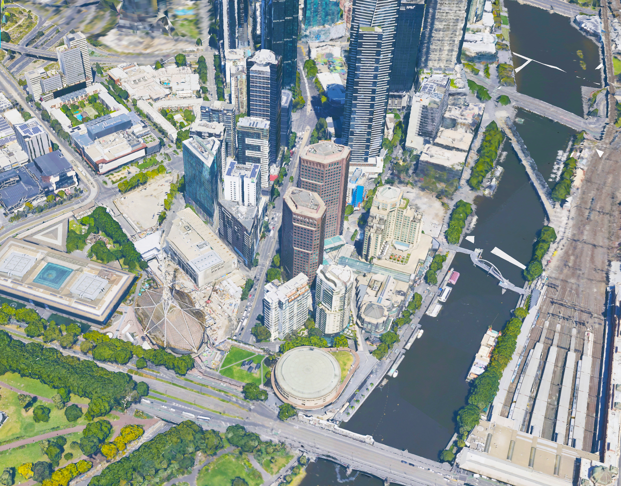
From reports to reality
WT Australia has long been known for delivering detailed cost models, but clients often found the data hard to engage with. The traditional method of lengthy spreadsheets and architectural overlays created a communication barrier. WT recognised that their insights could be more powerful if presented in a spatial, visual, and explorable format.
Two projects, one vision
Phase 1: Making cost models come alive
The first project created an interactive digital environment to communicate early design and cost modelling. Clients could visually explore how designs evolved and how cost and construction data aligned, reducing confusion and supporting faster decisions.
Phase 2: Facilities visualisation without the buzzwords
In the second project, WT turned its focus inward: scanning its own office spaces to build a layered geospatial view. The Terria platform brought together point cloud data, 360° imagery, asset and access information, and building management inputs. With increased asset clarity and operational insight, the team was able to demonstrate value to internal stakeholders and clients alike.
A multi-stage geospatial intelligence partnership
Phase 1 highlights
Integrated BIM + cost data + 3D city context
Used Terria’s story mode to guide client walkthroughs
Enabled explorable cost visualisation

Phase 2 highlights
Scanned multiple offices with point cloud and 360 imagery
Integrated access control, temperature, and facilities data
Used internally and externally to showcase spatial asset management
Ongoing value and future potential
Demonstrated scalable workflows for integrating live asset data
Provided internal teams with a portfolio-wide showcase tool
Positioned WT to lead client conversations about spatial asset insights at handover
“These projects have allowed us to bring data to life for our clients, from construction right through to asset use.”

Cristobal Sierra, Digital Engineer
Take your spatial project to the next dimension
See how teams like yours are building digital twins that engage stakeholders and accelerate decisions.