
TerriaJS in 2025 - A year in review
A year of transition, momentum and perspective
2025 was a defining year for TerriaJS. Not because of a single release, conference, or headline feature, but because it marked a shift in how the project is built, used and sustained. One year on from Terria’s spin-out as an independent company, TerriaJS continued to evolve as an open-source framework. At the same time, the team simultaneously built a commercial platform, grew partnerships, and supported an expanding global community.
This review looks back at 2025 through a team-wide lens: the challenges we navigated, the milestones we reached, the lessons we learned, and the perspectives that are shaping what comes next. Sharing this perspective helps make the trade-offs, priorities, and constraints behind TerriaJS more visible to the community it serves.
TerriaJS inside a growing ecosystem
Across government, research, consulting, and infrastructure, TerriaJS was increasingly used as the connective tissue for spatial digital twins, bringing together open data, proprietary datasets, 2D and 3D visualisation, analytics, and storytelling in a single environment.
At the same time, Terria as an organisation was investing heavily in:
Industry engagement through webinars, conferences, and publications.
A next-generation commercial platform: see Plans.
A growing team across engineering, data, design, and delivery.
This broader ecosystem shaped many of the technical and strategic decisions around TerriaJS throughout the year
From open-source framework to supported platform. Terria extends TerriaJS into a commercial environment designed for scale, governance and collaboration.
Balancing focus, capacity, and stewardship
Open Source and SaaS
One of the defining challenges of 2025 was focus.
As the core team invested significant effort into building and delivering a SaaS platform, the prioritisation of TerriaJS work had to be carefully managed. We dedicated our open source resources to refreshing and maintaining the foundations. Instead of introducing new features, we focused on improving documentation and vulnerability management, completing critical updates to React, MobX, SVG sprite, etc.
Much of the year’s effort went into work that is essential, but rarely visible:
Dependency upgrades.
Security hardening.
Build system modernisation.
Performance and stability improvements.
Read more about this year’s TerriaJS releases:
TerriaJS Release Notes 8.8.0: Webpack 5 Upgrade, Vector Tile Enhancements & More
TerriaJS Release Notes 8.9.2: A Fresh Look, Faster Maps & New Tiling Power
TerriaJS Release Notes 8.9.3 - 8.10.0: Under the Hood Upgrades and Enhanced Map Capabilities
TerriaJS Release Notes 8.11.0: Support for Google 2D Tiles Shipped
Open source in a changing regulatory landscape
Broader conversations around open-source governance, licensing, and responsibility, particularly in government contexts, also became more prominent in 2025. Questions around IP, stewardship and compliance increasingly shaped how organisations approach adoption.
These conversations didn’t always have easy answers, but they formed an essential backdrop to technical decision-making.
Read our post on FOSS4G 2025 Auckland reflections:
What moved forward in 2025
Product and platform progress
Despite constraints, the Terria Spatial Digital Twin platform saw steady, meaningful progress through 2025, including:
Development of Terria Settings - product components enabling users to manage their data and users
Improved performance and interoperability, especially with the Esri and Cesium ecosystems
Expanded support for modern basemaps, vector tiles, and data services
Continued refactoring towards a more maintainable, future-ready codebase
Expanded data catalogue with sources beyond Australia, both open and commercial
Exciting news for TerriaJS users, as we enabled the support for Google 2D Tiles standard, recently announced by Google and implemented promptly by Cesium.
Team growth and capability
2025 also marked growth in the team supporting TerriaJS and the broader platform:
New engineers, data specialists and UX designers joined, bringing depth in 2D/3D, performance, and geospatial systems;
Knowledge was distributed more intentionally across the team, reducing reliance on single maintainers.
This investment strengthened both delivery capacity and long-term resilience.
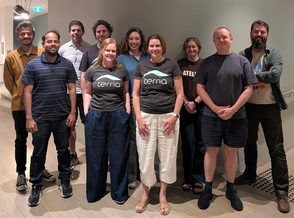
Team Terria at the quarterly ‘TerriaCon’, a 3-day product and business strategy intensive.
Community and industry engagement
TerriaJS maintained a strong presence across the global geospatial community in 2025:
Workshops, talks, and lightning talks (see more in the FOSS4G section below).
Webinars and panel discussions with partners across consulting, government, and research.
Case studies demonstrating real-world digital twins at different scales.
Tokyo Digital Twin
One example of TerriaJS in action at the city scale is the Tokyo Digital Twin Project. Led by the Tokyo Metropolitan Government in collaboration with Pacific Spatial Solutions and Mitsubishi Research Institute, it brings together a wide range of urban datasets in a single, accessible 3D environment.

Building figure: 1/2500 scale topographic map (Tokyo) (2021), Aerial photogrammetry (Tokyo) (2023), aerial photogrammetry (Kokusai Kogyo Co., Ltd.) (2020). Courtesy of Tokyo Metropolitan Government.
Built on TerriaJS and Cesium ION, the platform integrates open data portals, 3D city models, live feeds and environmental information to support disaster preparedness, urban planning and public engagement across one of the world’s largest and most complex cities.
Pasig River Digital Twin Project
Beyond city-scale implementations, TerriaJS is also being used to address environmental and sustainability challenges.
The Pasig River Digital Twin Project illustrates how TerriaJS and open spatial technologies are being applied to environmental and sustainability challenges at scale. In partnership with Arup, RiverRecycle, and the Asian Development Bank (ADB), this initiative combines AI-based waste classification, hydraulic flow models, open source satellite imagery, and hundreds of environmental and waste datasets to build an interactive digital twin of the 27 km Pasig River system in the Philippines.
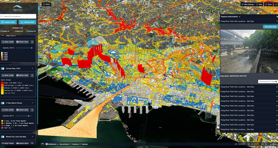
The Pasig River digital twin integrates multiple complex datasets to track the movement of plastic waste and other debris, which helps identify pollution hotspots and their sources.
The prototype platform helps stakeholders visualise how plastic waste moves through the river, identify pollution hotspots, and inform targeted clean-up strategies and policies – making complex, multi-source data accessible through a single map-based environment. This project highlights the role of digital twins in supporting real-world interventions that address global plastic pollution and demonstrates the impact of open technologies when paired with engineering expertise and cross-sector collaboration.
FOSS4G 2025: A moment of reflection and alignment
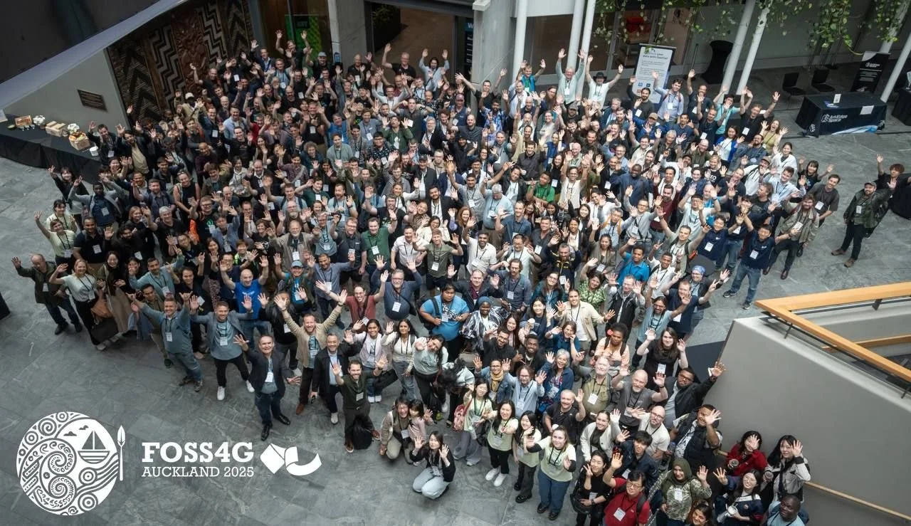
Conferences such as FOSS4G 2025 Auckland provided an essential focal point for these conversations, bringing together developers, researchers, and decision-makers around shared challenges and opportunities.
FOSS4G 2025 in Auckland offered a valuable lens for the year as a whole.
Across sessions and informal conversations, several themes stood out:
Digital twins are now being built at every scale – from research prototypes to city and national platforms.
Human-centred design and GeoAI are increasingly central, not optional.
Governments are standardising on open stacks for transparency, interoperability, and resilience.
Questions of IP, governance, and sustainability are becoming unavoidable for mature open-source projects.
For TerriaJS, it was particularly meaningful to see community-built implementations “in the wild”, often developed independently, yet aligned in values and approach. Lessons learned: What 2025 made clear
Open source maturity changes the work
As TerriaJS has matured, the work has shifted:
Less about proving capability.
More about reliability, trust, and longevity.
This means investing in foundations – sometimes at the expense of speed.
Adoption depends on more than technology
Across projects and partners, one lesson repeated itself: tools only succeed when they are trusted, understood, and usable by non-experts.
This reinforced the importance of:
Documentation and examples.
Human-centred design.
Clear communication of intent and limitations.
Sustainability is a shared responsibility
2025 highlighted that sustaining open-source infrastructure is not solely a maintainer problem. It requires:
Organisational buy-in.
Thoughtful funding and partnership models.
Ongoing dialogue between developers, users, and institutions.
New perspectives: How the year reshaped the roadmap.
Looking forward, 2025 sharpened several perspectives for the TerriaJS project:
The importance of being explicit about what TerriaJS is and what it is not.
A more apparent separation between core framework responsibilities and higher-level product features.
Greater openness about trade-offs, constraints, and priorities.
Rather than trying to be everything to everyone, the focus is increasingly on enabling others – partners, agencies, researchers, and developers – to build what they need with confidence.
Looking ahead: 2026 and beyond.
If 2025 was a year of consolidation and perspective, 2026 looks set to be about growing the team and leveraging the lessons learnt.
With stronger foundations, a growing ecosystem, and deeper community connections, TerriaJS is well-positioned to continue supporting open, scalable, spatially intelligent systems worldwide.
The work ahead remains complex, but the direction is more precise than ever. 2026 will be the ‘year of the map’ with new features and data formats to be developed and supported by both the open source TerriaJS and the SaaS platform.
Join the community and explore the details
🔹 Interested in joining our team, we’re hiring early-2026!
🔹 Dive into the full changelog on GitHub
🔹 Have ideas or questions? Start a thread in our Discussions.
🔹 Interested in contributing? Visit our developer guide to see how you can get involved.

About Terria
Terria makes it easy to build advanced maps and digital twins, so you can see the bigger picture. Our digital maps and spatial digital twin technology make it easy for you to unlock the full potential of your data, enabling faster, smarter decision-making. We help you transform complex data into clear, actionable insights, so you can tackle real-world challenges with confidence and precision.
At Terria, we believe that data transparency has the power to transform how businesses operate, make decisions, and engage with stakeholders—ultimately leading to better outcomes for all. Find out more here https://terria.io/about
To stay updated on all Terria Community activity, follow us on LinkedIn and X